Mapping


Voters approve digitized New York City map amid affordable housing push
Supporters said the new map, which was approved overwhelmingly last week, will help speed up approvals of new housing and development projects. Opponents warned it would centralize power away from the five boroughs.


Innovative mapping tool reveals hidden wetlands and enhances conservation efforts
An AI-powered model aids states and countries in planning and restoration priorities.


How the rapid spread of misinformation pushed Oregon lawmakers to kill the state’s wildfire risk map
After Oregon’s record-breaking fire season in 2020, lawmakers wanted to map out which properties were most at risk. But anger from homeowners escalated quickly.


Cities turn to tech to make curb ramps ADA-accessible
Localities must install or regrade their curb ramps when roads are changed, and they are using aerial photography, geospatial data and AI to help.


How Washington State maps current — and future — EV charging
The Evergreen State has turned to GIS to map charging infrastructure, as well as using other data to help guide planners on where they should invest next.


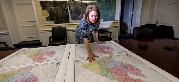
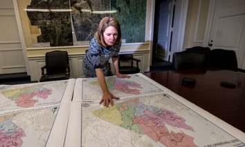
Mapping vulnerability in Arlington County, Virginia
Local leaders last month released the Community Vulnerability Index Map, which uses various data points to find vulnerable populations and inform where resources should be allocated.


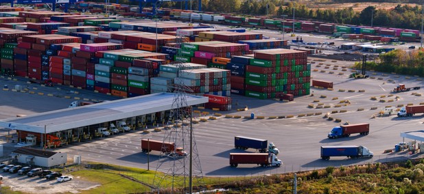
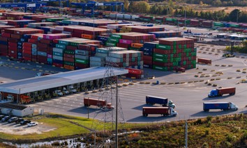
Digital twin helps Texas port track operations, plan ahead
The Port of Corpus Christi deployed its Overall Port Tactical Information Computer System to provide a “single pane of glass” to law enforcement and other authorities who monitor it.


How mapping tech is revolutionizing election administration
Few jurisdictions make use of geographic information system mapping, but those that do use it to help connect voters with polling places, manage requests and assets, and tabulate results.


Mapping clean air centers to protect residents against wildfire risks
As wildfire smoke or poor air quality descends upon California residents, officials hope a data map will help them find pockets of fresh air across the state.


What is your home’s wildfire risk?
An updated online tool allows towns and counties to get a sense of their wildfire risk without having to pay for expensive studies.
Featured eBooks