
Georgia fire department launches drone program to enhance public safety response
simonkr via Getty Images






A public safety agency in the state recently enlisted a drone to expedite first responders’ reaction and preparation for emergency calls.
The Sandy Springs Fire Department in Georgia is seeing early efficiency gains after recently launching a drone-as-a-first responder program, making it the first fire department in the state to do so.
The public safety agency launched the DFR program earlier this year after installing a docked drone system in a fire station located near a major intersection of Interstate 285 and state Route 400, which is about 13 miles north of Atlanta.
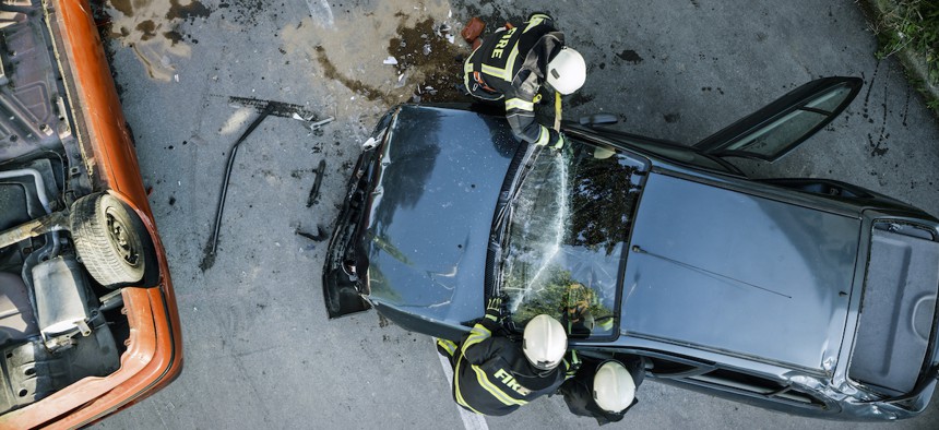
The intersection and surrounding areas experience significant traffic akin to “an absolute nightmare,” said Livingston Do, captain of technology and data at the Sandy Springs Fire Department. In fact, a 2025 city report showed that ,between 2018 and 2022, there were 27,502 reported crashes in Sandy Springs with 27% and 23% of crashes occurring on I-295 and Route 400, respectively.
When someone on a major road like I-295 and Route 400 needs to contact 911, it’s common for them to not know exactly where they are on a long stretch of highway, Do said. Plus, the build up of traffic can hinder efforts to locate and reach the caller once responders have been dispatched.
That’s where SSFD’s new drone becomes a key tool for public safety responders. The drone uses RapidSOS technology to determine a caller’s approximate GPS coordinates through their device, Do said. The drone operator can then maneuver the drone to the location to identify the individual or vehicle in need of assistance, while the drone livestreams the footage of the scene to responding personnel who have access to tablets in the fire trucks arriving at the incident.
“There's a big philosophy in the fire service that these fire trucks are basically big old toolboxes, and we want options for everything, so [for] whatever incident or occurrence, we want to have an answer for it,” said Do.
SSFD officials hope the DFR program will help first responders locate callers more efficiently, enhance their situational awareness and enable them to prepare resources and personnel proactively.
Indeed, the city’s new drone can arrive at a scene within minutes and “can save us up to 15 to 20 minutes before getting on the scene,” said Do.
Typically, SSFD dispatches two fire trucks to approach the scene from different directions. With the live drone footage, first responders can better plan “whether they're going on the access, the on ramp, the off ramp, before they have to commit to these super long stretches of highway, they wait and see, and then they make a decision based off of that,” he explained.
The drone has proved useful for other use cases beyond its original highway assistance role, including surveying buildings during emergency situations, Do added. SSFD also uses the drone to, for instance, assess buildings on fire to reveal smoke in areas that personnel cannot see from their perspective.
SSFD will measure the impact of the docked drone system by collecting data on the device’s flight hours, analyzing 911 calls and geomapping where drone-enabled responses occur to further evaluate where the agency could expand the drone program in the city, Do said.
As an example, he pointed to the upcoming summer season that usually draws residents and visitors to a nearby recreational park. Drone technology can enhance efforts to locate lost or injured park visitors, expediting and optimizing rescue missions.
The DFR program is “making those [first responders] who are already going out there more efficient, and we’re making sure that they’re not missing anything and that they’re getting to you faster — it’s increasing the quality of service [more] than it is … increasing cost of the service,” Do said.