Local Texas officials turn to AI to enhance flood management
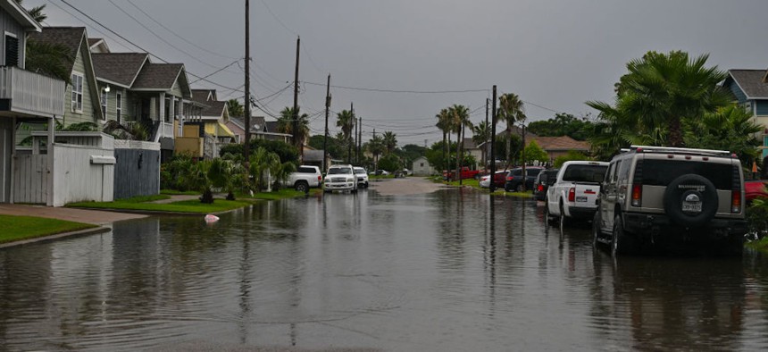
Shown is a flooded Q Street at 59th Street on June 5, 2024, in Galveston, Texas. Ricky Carioti/The Washington Post via Getty Images


The Galveston County Consolidated Drainage District launched a new data system to turn historical and real-time flooding data into predictive analytics.
Texas is one of the nation’s most at-risk states for flooding as its hot, dry climate and proximity to the Gulf of Mexico make it susceptible to hurricane events and stormwater runoff.
Indeed, the state reported more than 100 deaths last year after major flood waters ripped through Central Texas. The July 4, 2025 event made national headlines after reports that nearly 30 children and camp staff were killed after waters swept through Camp Mystic in Kerr County.
Preventing such tragedies is the main goal of the Galveston County Consolidated Drainage District, said Rusty Burkett, the district’s board president. The district, which is located about 30 miles south of Houston, recently deployed a network of radar sensors as part of a broader flood data intelligence platform that officials will use to monitor water levels across the cities of Friendswood and League.
“I think flooding and drainage [are] the number one threat to lives and property in Galveston County,” Burkett said. That’s why GCCDD is “focused on” the “flood mitigation techniques to protect the people and property in the tax base and the vitality of this area," he added.
Indeed, GCCDD maintains approximately 72 miles of creeks and tributaries for flood and drainage management, said Paige Bailey, executive director and general counsel of GCCDD. The sensors — which each cost less than $10,000 — were deployed at seven sites and went live in April.
Data insights from the sensors will also inform GCCDD officials’ emergency response and flood prevention efforts to ensure the protection of people and property, Burkett said. Additional data sources include local weather feeds and data from the National Oceanic and Atmospheric Administration and the U.S. Geological Survey, which he said will help GCCDD better understand historical flood trends.
GCCDD is planning to expand its sensor network to include LiDAR sensors that will monitor the flow of water for enhanced insights, which Burkett said will be critical for predicting flooding conditions and events in communities.
For data analysis and visualizations, the district is using a flood intelligence platform developed by Simplicity Integration, a flood management company, and powered by a decision intelligence system from Axonis, an AI company.
The platform will also send automated, localized text alerts to people if the sensor system detects that water is rising to an at-risk level determined by officials, said Alison Reese, Simplicity Integration’s chief operating officer and co-founder. The system can also connect with existing infrastructure to, for instance, trigger sirens or activate barrier systems that look to manage incoming flood waters.
The flood intelligence system has “already mapped out some locations where we need more stream gauges, more sensors and some additional LiDAR [sensors] … in order to give our community the best possible information,” Bailey said.
Adopting and implementing such solutions “is just one bullet in our arsenal for public service,” Burkett said. “We're going to get some really accurate information about predictive flooding, which has never happened before.”