
How GIS data helps airports improve customer experience
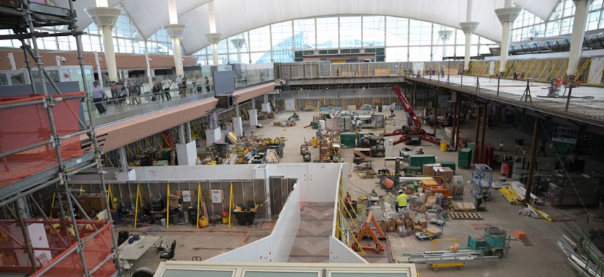
Construction site of Denver International Airport in Denver on Wednesday, May 22, 2024. Hyoung Chang/The Denver Post






As airports look to expand their operations, geospatial data is emerging as a tool to manage passengers’ expectations amid those operational changes, observers say.
Airports play an important role in shaping localities’ customer experience for travelers whose experience with a new city begins and ends at their terminal. That’s why officials are turning to geospatial data as a tool to improve those travelers’ navigation of airport services and infrastructure, observers say.
Dallas Fort Worth International Airport in Texas is one airport prioritizing data-driven customer experience, said Adan Banda, geospatial data manager of technology services for DFW.
The airport sees nearly 90 million passengers annually and operates seven runways, five terminals and more than 160 gates. The facility spans 26.9 square miles of property, which is slightly larger than Manhattan Island in New York City.
“We're basically a big city that we're trying to turn into a smart city,” Banda said.
To do that, DFW staff are using GIS data to build wayfinding tools for customers to use within the DFW Airport app, which is supported by Esri’s ArcGIS Indoors platform, he said.
Officials are currently piloting a mapping feature that customers could use to find their routes from entering the airport to finding the nearest TSA checkpoint, a people-mover entrance or concession stands.
Staff are also looking to connect internal mapping services with exterior infrastructure to streamline customers’ navigation upon entering or exiting the airport grounds through toll plazas, Banda explained.
“We want to mitigate as much time outside of the terminals as we can,” Banda said, adding that, if data shows that visitors are stuck on the curbside, “that means we’re not doing something right …. We're not either getting them off the property, [or] we're not getting them into the property properly.”
A campus-wide deployment of the wayfinding feature is planned to launch next year, which will be particularly valuable as officials continue to expand current infrastructure and services, Banda said.
As an example, he pointed to a $1.6 billion project that’s currently underway to open a new terminal in June with the full expansion due to be complete in 2030. The terminal will include 15 new gates, modernized baggage handling systems and a new people mover track.
The new terminal is part of a broader $12 billion capital improvement plan that initially launched in 2024 and is aimed at modernizing and enhancing the airport campus and capabilities, Banda explained.
The GIS data and platform also help staff improve asset management, he said. Workers can more efficiently report and address work orders across the airport to fix HVAC systems, fleet vehicles, conveyors and other airport assets.
Standing up the tools to ensure a positive experience among the airport’s customers and staff is particularly important as the publicly owned facility is a large economic and employment driver in the state, he said.
Indeed, DFW contributes an estimated $78 billion to the North Texas economy and supports 684,000 jobs annually, according to a 2025 report.
Denver International Airport in Colorado is also exploring GIS data capabilities to inform infrastructure planning and improvements, said Chelsea Seiter-Weatherford, the airport’s geospatial program manager.
Denver’s airport — the largest in the U.S. — spans 53 square miles, employs more than 43,000 staff and handles about 82 million passengers annually, Seiter-Weatherford said.
Using GIS data helps us ensure “that we’re building for the current flow of passengers” while also considering “future passenger flow and commercial and residential businesses being planned around our property,” she explained.
Officials at the airport, for example, have launched two major goals to increase the number of passengers coming through the facility, which rakes in about $47 billion annually for the state.
Vision 100 looks to prepare Denver to handle 100 million annual passengers between 2030 and 2035, though the airport is projected to hit that goal as early as next year.
A separate plan, Operation 2045, is aimed at increasing the annual passenger total to 145 million by 2045, Seiter-Weatherford said. That work includes major construction projects to expand security checkpoints, improve nearby roadways and construct new airport gates, several of which have already begun this year.
Airport staff currently use indoor GIS data mapping capabilities to manage office space for meetings or employee assignments, and officials are looking to use such services for broader infrastructure planning as well, she said.
“We want to do data analytics on all of the lease spaces and eventually [expand] into real-time data capturing passenger travel movement through the terminal and the concourses,” Seiter-Weatherford said
Such data “will tell us there's a lot of traffic here, or there tends to be a lot of traffic early in the morning in Concourse A, but there's no concessions open, so maybe we need to rethink concession hours” and locations, she explained.
Other public-facing data tools the airport is considering are kiosks that function as digital maps for customers to use while navigating the facility, she said.
GIS data is a critical tool for airport management because by “having it available to both employees and to the public, you can get around a really crazy airport a lot easier,” Seiter-Weatherford said.
“We’re always going to be under construction … Walls are always going up, and signs are always changing. We want the passengers to have a positive experience, and I think [leveraging] our indoor data is going to be an amazing step forward,” she said.