


When the National Cancer Institute wanted help assessing the relationship between environmental factors and breast cancer for the Long Island Breast Cancer Study Project, it asked AverStar Inc. of Burlington, Mass., to develop a prototype geographic information system to initiate the study.
By J.B. MilesSpecial to GCNWhen the National Cancer Institute wanted help assessing the relationship between environmental factors and breast cancer for the Long Island Breast Cancer Study Project, it asked AverStar Inc. of Burlington, Mass., to develop a prototype geographic information system to initiate the study.AverStar officials said the GIS will be the first system to provide data for the relationship between breast cancer and exposure to environmental hazards such as contaminated drinking water, air pollution, electromagnetic fields and radiation, pesticides and other toxic chemicals, and hazardous and municipal wastes.The project is just one example of the growing number of uses for systems that put data of all kinds into a geographic context.The Global Forest Watch program is using GIS software donated by Erdas Inc. to analyze satellite imagery and map the precise condition of forests in Russia, Canada, Venezuela, Chile and the United States to help identify threats such as logging, mining, road building and other forest development.Global Forest Watch was launched earlier this year by the World Resources Institute to map and publicly document forest development activities around the world.New England Electrical System companies are using a GIS to better manage their right-of-way corridors through the forests and townships of New England.The Kenerson Group, a Boston GIS consulting agency for public utility industries, developed the Vegetation Integrated Information Management Solution using the ArcView GIS from Environmental Systems Research Institute.'Transmission systems occupy sensitive habitat, adjoin or occupy areas owned by private citizens, and can interrupt or displace ecosystems,' said Kerri Kenerson, director of the Kenerson Group. The VIIMS system was designed to help the utility company maintain its right-of-way without impinging on these other concerns, she said.Both large- and small-scale projects can make use of a GIS. MapObjects, from ESRI, is used in conjunction with ShotSpotter from Trilon Technology LLC and Bradshaw Consulting Services Inc., and the Communicator from Dialogic Communications Inc. to help find ways to reduce illicit gunfire in urban areas.ShotSpotter first detects gunfire with specialized microphones strategically placed within high-crime areas. It then uses MapObjects to locate exactly where the shots were fired. MapObjects generates map and aerial photograph displays and provides law enforcement with the name, address and phone number of the home or business closest to the gunshot. The Communicator then uses this information to initiate a system of rapid notification to area residents.The use of GIS applications is expanding annually as industrial, economic, military and government planners learn to harness their benefits. Total GIS core business revenues worldwide'including software, hardware and services'reached $1.5 billion last year, up 10.6 percent from 1998, according to a study by Daratech Inc., a Cambridge, Mass., market research company.GIS software revenues alone accounted for $845 million, a 12.8 percent increase over 1998, the Daratech study disclosed.This guide lists desktop PC GIS programs that are compatible with Windows 95, 98 and NT operating systems, as well as Mac OS for the Macintosh and various flavors of Unix for such workstations as the Sun Microsystems Sparcstation series.Although there are relatively few, I selected them for their versatility. Most can easily be customized to meet goals as diverse as studying the effects of pesticides on wildlife in Michigan, finding the best site for an airport in Florida, or determining the amount of toxic waste oozing from a landfill into a swamp at the end of a street.Some vendors listed, notably industry leaders such as Caliper Corp., Caris Ltd., Erdas, ESRI and Intergraph Corp. provide entire suites of GIS modules targeted to specific industries or interest groups. The products are too numerous to list here. More information is available on the companies' Web sites.Other GIS software manufacturers market their products as part of service packages for a number of industry functions, such as oil and gas exploration, municipal planning or public utility operation. For a list of these and manufacturers of other GIS products, visit , an excellent online source of GIS news and developments worldwide.By definition, a GIS is a system designed to work with data referenced by spatial or geographic coordinates. GeoMicro Inc., a GIS software company, defines a GIS as a program that 'captures, stores, retrieves, analyzes and displays spatial data using a set of hardware, software and procedures.' A GIS combines the capabilities of databases with the visualization and geographic analysis offered by maps, according to a company white paper.A Geological Survey report on geographic information systems lists six basic functions that GIS programs should perform Check the USGS' Web site, at , for more details: If an Idaho farmer could relate information about the rainfall in his state to aerial photographs of the county where his potato farm was located, he might be able to gain information about optimum planting and harvesting times. By using a GIS, he could input information from many different sources and in many different forms for a solid analysis of the results.In any case, the primary requirement for the source data is that the GIS recognizes the locations of all variables, which are annotated by x, y or z coordinates of longitude, latitude and elevation, or by other systems such as ZIP codes or mile markers. Because any variable that can be found spatially can be digitized and fed into a GIS, it is possible to use various types of digital information such as satellite images and census data in the system. If data to be used by the GIS isn't already digitized, the program can use various techniques to capture it. For example, portions of maps can be digitized by drawing around them with a computer mouse or by using electronic scanners to convert map lines and points into digital data.Once a GIS has captured and digitized data, extraneous data can be edited out and the resulting information placed into a specialized database. A GIS can link information from various, usually incompatible sources by using combinations of mapped variables for building and analyzing new variables.The Geological Survey cites the example of researchers who combine data from a GIS and billing information from a water company to simulate the discharge of materials in the septic systems in a neighborhood upstream from a wetland. The water bills show how much water is used at each address, and the total amount of water used by the neighborhood helps predict the amount of material that will be discharged into the septic system. Thus, a GIS can identify neighborhoods with heavy amounts of septic discharge. Maps are designed according to different scales, but a GIS can adjust the scale of one map to fit another's. If the maps use different types of projection'a mathematical method of transferring information from the Earth's three-dimensional curved surface to two-dimensional paper or computer screen displays'the GIS can blend the projections into a common one using a PC or workstation. Digital data is collected and stored in many ways, so two data sources may not be compatible. A GIS can make them compatible by restructuring the data; that is, converting it to different formats. In this way, a regional property map may be related to a satellite image of the entire area. The Geological Survey cites such problems as the difficulties of relating wetlands maps to rainfall amounts recorded at several points, such as airports, TV stations and high schools. Because a GIS can depict two- and three-dimensional characteristics of the Earth's surface, subsurface and atmosphere from many information points, it can generate a map with rainfall contour lines that indicate rainfall amounts in specific locations.XXXSPLITXXX-
Geographic information systems add new dimensions to mapping
Useful utility
www.geoplace.com
www.usgs.gov
Relating information from different sources.
Data capture.
Data integration.
Projection and registration.
Data structures.
Data modeling.
J.B. Miles of Pahoa, Hawaii, writes about communications and computers.
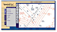 | Map Viewer Web, part of Byers Engineering's Map Viewer series, allows databases via the Internet or an intranet. Its price ranges from $300 to $1,500. |
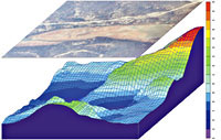 | Mapping features in Rockware's RockWorks99 include the ability to present a 2-D aerial photo over a 3-D color mesh of the land's topography. RockWorks99, which is updated weekly, is priced at $899 for one user and $4,999 for a 10-user license. |
Useful utility
www.geoplace.com
| ' Information retrieval. A user can point to locations, objects or areas on a computer screen to access information about them from its database. ' Topological modeling. A GIS can recognize and analyze spatial relationships among mapped phenomena. A user can determine conditions of adjacency'what is next to what; containment'what is enclosed by what; and proximity'how close something is to something else. ' Networks. A GIS can simulate the movement of materials along a linear network. By assigning digitized values such as direction and speed to the | motion of contaminants, for example, a GIS could determine how long it would take pollutants to move from a toxic site to an uncontaminated area. ' Overlay. A GIS can produce many kinds of maps, for areas such as wetlands, slopes, streams, properties and soils. A user can combine map data to produce a map layer that, for instance, would illustrate effects of nearby building sites on wetlands. ' Data output. A GIS can show the results of a complex analysis in graphic form on a monitor or a printout for departmental or agency decision-makers. |
www.usgs.gov
Relating information from different sources.
Data capture.
Data integration.
 | Caliper's GIS+ 3.5, designed for professionals, can be used to create and maintain 3-D data sets. It's priced at $2,995 per license. |
Projection and registration.
Data structures.
Data modeling.
J.B. Miles of Pahoa, Hawaii, writes about communications and computers.
| Vendor | Product | Platform | Description | Features | Price |
| Applied Biomathematics Corp. Setauket, N.Y. 800-735-4350 www.ramas.com | Ramas GIS 3.0 | Win9x, NT | Ecological GIS software that links landscape data with population viability analysis for endangered animal species | Imports landscape data from a GIS, identifies habitat patches, builds a metapopulation model and performs viability analysis and risk assessment; has a user-friendly interface | $1,595 per single-user license |
| Avenza Software Inc. Burlington, Ontario 905-639-3330 www.avenza.com | MAPublisher 3.5 | Mac OS, Win9x, NT | A suite of Xtras for Macromedia FreeHand and plug-ins for Adobe Illustrator 8.0.1 that bridges GIS technology with high-end graphics software for high-resolution printing and electronic publishing | Has import filters, map scale tools, table of attribute values, column mapping tools, add column, edit column, drop column, selection management tools | $495 |
| Autodesk Inc. San Rafael, Calif. 415-507-5000 www.autodesk.com | AutoCAD Map 2000 | Win9x, NT | For precision mapping and analysis in an AutoCAD environment | Features querying, properties window, presentation and plotting, nonrectangular viewports, multiple map assets, multiple layouts, multiple design environment, map creation and cleanup, GIS spatial analysis, flexible plot styles, data integration, coordinate conversion, construction tools | $4,250 |
| Byers Engineering Co. Atlanta 404-843-1000 www.byers.com | Map Viewer Series 8.0 | Win9x, NT | A family of products designed for telecommunications professionals to navigate and analyze areas, propose equipment and routing costs, print maps and distribute plans | Provides big-picture view of the network, with detail filters, file overlays and multiyear planning; imports and displays geocoded data, performs spatial queries, projects multiple what-if scenarios, prints to standard Windows printers and plotters, captures competitive information, views entire service areas or user-defined boundaries, dynamically displays Global Positioning System coordinates | $300 to $1,500 |
| Caliper Corp. Newton, Mass. 617-527-4700 www.caliper.com | GIS+ 3.5 | Win9x, NT | A system for professional users that provides tools for the creation, validation and maintenance of geographic databases and a range of spatial analysis tools. Supports data visualization, custom map design, map display and access to all software functions | Has true 32-bit Windows application code, client-server processing, multi-user database access, GPS interface, support for digital orthophotography and satellite-derived base maps, support for 3-D databases, address matching, thematic mapping tools, WYSIWYG page layout tools, network analysis tools, a GIS Development Kit | $2,995 per license |
| Caris Ltd. Fredericton, New Brunswick 506-458-8533 www.caris.com | Caris GIS 4.3.5 | Win9x, NT, Unix | A full-featured GIS with editing, query, analysis and visualization capabilities | Has two, three and "n" dimensional data viewing, extensive cartographic capabilities, support for multiple map projections, GIS analysis and modeling tools, support for multiple RDBMSes and data exchange formats, plotting capabilities, data compaction, open environment, full functionality on Windows and many Unix platforms | $635 to $5,000 |
| Comgrafix Inc. Clearwater, Fla. 800-448-6277 www.comgrafix.com | MapGrafix 4.01 | Mac OS | A tool that links every map feature, graphic or text with database information to relate descriptive data to specific geographic locations | Supports real-world coordinate systems, uses intelligent cartographic data structures, supports standard vector formats, imports raster images in TIFF format, has open architecture for customized applications, has comprehensive editing functions | $995 |
| Digi-Rule Inc. Calgary, Alberta 403-292-0320 www.digirule.com | DIGGIS 1.04 | Win9x, NT | A tool that captures data for export into any GIS program using a digitizing table or The Rat portable digitizer | Digitizes any map feature, works with standard digitizing tables, uses Windows Graphic User Interface, has multiple editing tools, converts data to true coordinates, imports data from .dxf files or other data vendor formats, supports most popular printers and plotters | $995 per seat |
| Erdas Inc. Atlanta 877-463-7327 www.erdas.com | Imagine 8.4 | Win9x, NT, Windows 2000 | A full-featured GIS program with multiple components | Add-on modules include VirtualGIS, Vector, NITF, OrthoBASE, Subpixel Classifier, Developer's Toolkit, Radar Mapping Suite | $2,000 up |
| Environmental Systems Research Institute Redlands, Calif. 714-793-2853 www.esri.com | ArcView GIS 3.2 | Win9x, NT, Unix | A customizable desktop PC mapping and spatial analysis program | Features visual mapping, cartographic wizards, labeling and text tools, industry and application symbols, Crystal Reports report writing, on-the-fly data updating, analysis wizards, geographic hot links to all supported data formats, client-server access to data warehouses, comprehensive developer environment | $1,195 per seat |
| GeoMicro Inc. Santa Ana, Calif. 714-444-9240 www.geomicro.com | AltaMap Professional 2.0 | Win9x, NT | A set of OLE/COM objects for building applications. Includes more than 20 programmable objects with 250 properties, methods and custom events. Works in standard development environments such as Visual Basic, Delphi and Visual C++. | Includes record object, spatial indexing, animation layer, thematic mapping objects, query and selection model, cross-layer smart labeling | $2,495 |
| Georef Systems Ltd. Waterloo, Ontario 519-747-7623 | MapSpace 6.02 | Win9x, NT, Win 2000 | For a single user or client-server | Available in single-user or client-server applications | $900 per single user license |
| Intergraph Corp. Huntsville, Ala. 800-791-3357 www.intergraph.com/gis | GeoMedia 4.0 | NT | An enterprise app with expanded data access and integration tools, improved plotting and workflow features and many other enhancements over earlier GeoMedia versions | Has expanded data server support (Oracle 8i Spatial Object Model data server, Microsoft SQL Server and others), advanced plotting capabilities, CAD-like data capture tools, open standards support including Extensible Markup Language, Geographic Markup Language and Wireless Markup Language | $1,500 up |
| MapInfo Corp. Troy, N.Y. 518-285-6000 www.mapinfo.com | MapInfo Professional 6.0 | Win9x, NT | A full-featured mapping program | Includes Internet support, charts and graphs, layering, 3-D viewing, thematic mapping and templates, continuous thematic shading and raster image support; attaches data to map objects, can link views, builds and saves SQL queries, creates buffers around objects, does geographic searches; has Crystal Reports, a drop and drag tool, built-in conflict management, server-side storage and data management, universal translator | $1,295 |
| PCI Pacific GeoSolutions Inc. Victoria, British Columbia 250-382-5800 www.pci-pacific.com | PAMAP GIS 5.2b | Win9x, NT | A comprehensive set of tools for analyzing point, vector and area information | Includes Mapper with data input, editing, display and query tools; Analyzer with comprehensive statistical reports, specific or variable width corridors, distance-form analysis, simultaneous overlays of multiple polygon covers; Topographer for 3-D analysis and visualization; Networker for building network topology from line and point elements; Modeller for developing complex models for solving difficult planning problems; Data Presentation and Plotting, PAMAP GIS Translators and Filtering | $5,000 |
| Proactive Surface Solutions Inc. Calgary, Alberta 888-477-6447 www.progis.com | Rapid Emergency Response Plan 2.0 | Win9x, NT | Emergency response planning on WinGIS 2000 from Austrian GIS manufacturer ProGIS Corp. | Does enterprise resource planning and development with interactive software detailing database information and maps of facilities, pipelines, residents, wellheads, roads and land markers; provides ongoing resident contacts and updates, design and distribution of resident information packets, land negotiations and mutual aid agreements | $300 up per user |
| Rockware Inc. Golden, Colo. 303-278-3534 www.rockware.com | RockWorks99 | Win9x, NT | Geological data management, analysis and visualization software | Performs point mapping with multivariate symbol maps, contour maps, 3-D surface diagrams, land grid utilities, surveying utilities, gridding tools, solid modeling, volumetrics, stratigraphic diagrams, statistics, lineation analysis, planar feature analysis, geotechnical analysis, hydrology, hydrochemistry, coordinate conversions, geological tools, Virtual Reality Modeling Language, advanced 3-D visualization, graphic utilities, Import/Export options | $899 per single user, $4,999 per 10 users |
| Safe Software Inc. Surrey, British Columbia 604-501-9985 www.safe.com | FME Professional Suite 2000 | Win9x, NT, Unix | General purpose, full-featured data migration and translation software | Supports the databases and data formats of most popular GIS programs | $1,749 up |
| Uclid Software LLC Madison, Wis. 877-778-2543 www.uclid.com | IcoMap 2.2 | Win9x, NT | Modularized land parcel conversion software | Converts maps, deeds and legal descriptions into vector files; does specialized text conversion, batch-text recognition, distance and bearing interpreter, source document linking | $1,995 up |