
Missouri launches statewide app to help officials, residents prepare for flooding
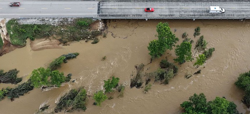
High water levels submerge trees along a bridge on Route 21 on the Black River due to flash flooding in Centerville, Missouri, and the surrounding region on Friday, July 10, 2026. Liz Rymarev/St. Louis Post-Dispatch via Getty Images





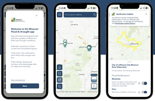
The Missouri Hydrology Information Center has designed a mobile app and website aimed at making complex flood and drought data easier for the public and government users to navigate.
Missouri is no stranger to major flood disasters throughout history, particularly as it is home to the Missouri-Mississippi river system, the longest in North America. Some of the state’s biggest flood events date back to the 1800s, and recent disasters have motivated state officials to tackle historical problems with modernized data modeling tools.
In 2019, Missouri and other Midwest and Southern states were hit by historic floodwaters in March. The flooding resulted in widespread crop damage and billions of dollars in damages to communities, including $1.2 billion in levee repair costs, according to the Missouri Department of Natural Resources.
Missouri again saw rainfall that reached up to 14 inches and flash floods that were linked to at least one death last month, the St. Louis Public Radio reported.
The Missouri Department of Natural Resources has developed new data modeling tools aimed at providing real-time data on flood conditions and predicted flood risks across the state, Zack Becker, unit chief of the Hydrology Information Center at the Missouri Department of Natural Resources, told Route Fifty.
The tools include a mobile app and website where residents, government leaders and other users can monitor live flood conditions, short-term and five-day flood predictions, drought conditions and soil moisture.
The app and website platforms were developed using Esri’s ArcGIS Hub. With the app version, users can subscribe to push alerts to inform them of changing flood conditions, Becker explained. Flood- and drought-related data is color-coded based on the severity of conditions, and users can customize the information and alerts they interact with.
Missouri hopes to lead other states in creating such resources “to be as usable for the public as possible,” Becker said.
“Sometimes technical people build products for technical people, or they assume their knowledge and their expertise is consistent [in people] everywhere … and no one can use it because it’s just way over their head,” he explained, adding that “we intentionally worked with the symbology team at Esri to ask the question, ‘How would someone from the public look at this information? How would they understand the colors here?”
The platforms pull data from the state’s network of streamgages and sensors that monitor local soil moisture levels, he said. The platforms also rely on data from federal resources, such as the U.S. Geological Survey’s roughly 274 streamgages in the state and the National Oceanic and Atmospheric Administration’s National Water Model.
All together, the network “really powers the platform in terms of actionable data,” Becker said.
In fact, the platforms were updated in July to include 93 state park and historic site boundaries and labels after its initial launch in April, state officials announced. The recent expansion can help the Missouri Division of State Parks more efficiently monitor flood conditions, and ultimately, better coordinate with local law enforcement, emergency management agencies and first responders across the state during flood events.
The Hydrology Information Center and its data collection and modeling work is backed by $10.4 million in American Rescue Plan Act funds it received in fiscal 2023, Becker said.
DNR is continuing to install gauges and sensors, prioritizing underrepresented areas where data gaps exist or where communities do not have the financial capacity to purchase and install the devices, Becker said. The state has already deployed approximately 47 devices.